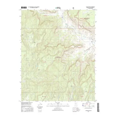
2017 Map of Laguna Peak
USGS Topo · Published 2017About this map
Laguna Peak anchors this high-elevation landscape where the Carson National Forest and Santa Fe National Forest meet in Rio Arriba County. The terrain is defined by a series of massive mesas, including Mesa de los Viejos and Mesa Alta, which are bisected by deep drainage systems like Chavez Canyon and Cañada de la Fuertes. The Rio Chama flows through the northeastern sector, providing a vital water source in this arid environment alongside numerous named seeps such as Potrero One Spring and Los Indios Spring. Modern infrastructure is represented by Obama Canyon Road, while the Continental Divide National Scenic Trail winds through the central corridor, following the rugged topography of the mesas. This survey captures a landscape primarily managed for conservation and recreation, where traditional land names like Mesa Gurule and Mesa Corral persist alongside protected wilderness.
Find a feature on this map
40 named features on this map. Tap any name to fly to it.
Don’t see what you’re looking for? This feature index may not catch every label — zoom into the map to look around manually.
Map Details
Editions of this 2017 Laguna Peak Map
This is the sole edition of this map. No revisions or reprints were ever made.
Other maps of this area

1909 · Gallina
USGS Topo · 1:125,000

1940 · Cuba
USGS Topo · 1:62,500

1943 · Cuba
USGS Topo · 1:62,500

1953 · Alire
USGS Topo · 1:24,000

1953 · Echo Ampitheater
USGS Topo · 1:24,000

1953 · Arroyo Del Agua
USGS Topo · 1:24,000

1953 · Laguna Peak
USGS Topo · 1:24,000

1953 · Navajo Peak
USGS Topo · 1:24,000

1953 · Youngsville
USGS Topo · 1:24,000
1953 · Youngsville
USGS Topo · 1:62,500