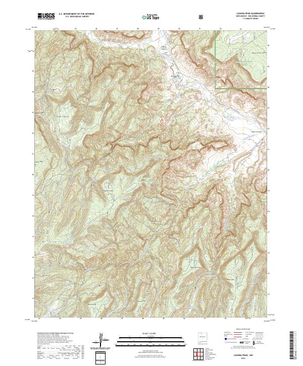
2023 Map of Laguna Peak
USGS Topo · Published 2023About this map
Rio Chama flows through a landscape of high mesas and deep canyons within the Chama River Canyon Wilderness, where the river is designated as the Rio Chama Wild and Scenic River. The terrain is defined by dramatic elevations such as Laguna Peak and expansive flats like French Mesa and Mesa de los Viejos. This 2023 survey documents a network of named springs, including Potrero One Spring and Gallegos Spring, which provide critical water points in this arid environment. The Continental Divide National Scenic Trail traverses the eastern half of the quadrangle, crossing Cañada Gurule and passing near the Ojitos Canyon. The abundance of Spanish-named features like Mesa Gurule and Mesa los Indios reflects the deep cultural history of these land grants and traditional grazing areas in Rio Arriba County.
Find a feature on this map
43 named features on this map. Tap any name to fly to it.
Don’t see what you’re looking for? This feature index may not catch every label — zoom into the map to look around manually.
Map Details
Editions of this 2023 Laguna Peak Map
This is the sole edition of this map. No revisions or reprints were ever made.
Other maps of this area

1909 · Gallina
USGS Topo · 1:125,000

1940 · Cuba
USGS Topo · 1:62,500

1943 · Cuba
USGS Topo · 1:62,500

1953 · Alire
USGS Topo · 1:24,000

1953 · Echo Ampitheater
USGS Topo · 1:24,000

1953 · Arroyo Del Agua
USGS Topo · 1:24,000

1953 · Laguna Peak
USGS Topo · 1:24,000

1953 · Navajo Peak
USGS Topo · 1:24,000

1953 · Youngsville
USGS Topo · 1:24,000
1953 · Youngsville
USGS Topo · 1:62,500