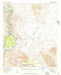
1955 Map of Laguna
USGS Topo · Published 1957About this map
The Colorado River and Gila River converge in this mid-century desert landscape, dominated by the massive water management infrastructure of the Imperial Reservoir and Imperial Dam Spillway. The map details the complex irrigation network that transformed the region, featuring the All American Canal, Gila Gravity Main Canal, and Wellton-Mohawk Canal. On the Arizona side, the Yuma Test Station occupies a significant portion of the terrain between the Laguna Mountains and the Castle Dome Mountains.
Find a feature on this map
65 named features on this map. Tap any name to fly to it.
Don’t see what you’re looking for? This feature index may not catch every label — zoom into the map to look around manually.
Map Details
Editions of this 1955 Laguna Map
3 editions found
Other maps of this area

1903 · Yuma
USGS Topo · 1:125,000

1905 · Yuma
USGS Topo · 1:125,000

1926 · Fortuna
USGS Topo · 1:62,500

1926 · Wellton
USGS Topo · 1:62,500

1929 · Fortuna
USGS Topo · 1:62,500

1929 · Laguna
USGS Topo · 1:62,500

1929 · Wellton
USGS Topo · 1:62,500

1939 · Red Hill
USGS Topo · 1:62,500

1940 · Yuma
USGS Topo · 1:62,500

1942 · Yuma
USGS Topo · 1:250,000