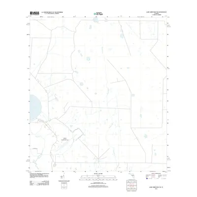
2012 Map of Lake Arbuckle NE
USGS Topo · Published 2012About this map
MacDill Air Force Base Auxiliary Field anchors this landscape in Polk County, showing the specialized infrastructure of military aviation in central Florida. The terrain is defined by a complex hydrographic system where Lake Arbuckle feeds into the winding course of Arbuckle Cr. To the east, the drainage of Morgan Hole Cr and the artificial engineering of the Rim Canal suggest a history of water management and land reclamation. These features, along with E Arbuckle Rd, trace the intersection of government land use and the natural wetlands characteristic of the region.
Find a feature on this map
6 named features on this map. Tap any name to fly to it.
Don’t see what you’re looking for? This feature index may not catch every label — zoom into the map to look around manually.
Map Details
Editions of this 2012 Lake Arbuckle NE Map
This is the sole edition of this map. No revisions or reprints were ever made.
Other maps of this area

1952 · Fort Kissimmee
USGS Topo · 1:24,000

1952 · Lake Weohyakapka SE
USGS Topo · 1:24,000

1952 · Lake Arbuckle SW
USGS Topo · 1:24,000

1952 · Fort Kissimmee NW
USGS Topo · 1:24,000

1952 · Lake Arbuckle NE
USGS Topo · 1:24,000

1952 · Lake Arbuckle SE
USGS Topo · 1:24,000

1952 · Lake Arbuckle
USGS Topo · 1:24,000

1952 · Lake Weohyakapka
USGS Topo · 1:24,000

1953 · Lake Marian SW
USGS Topo · 1:24,000

1956 · Fort Pierce
USGS Topo · 1:250,000