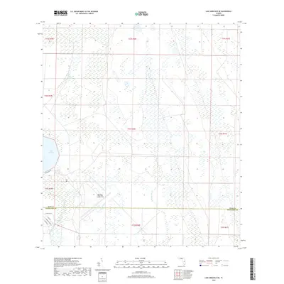
2018 Map of Lake Arbuckle NE
USGS Topo · Published 2018About this map
Blue Jordan Swamp and the dense wetland networks of central Florida dominate this landscape, where the borders of Polk and Highlands counties meet. The map reveals a transition from the natural drainage of Morgan Hole Cr to the more structured water management seen in the Rim Canal and near the northern shores of Lake Arbuckle. A significant portion of the southern terrain is occupied by the MacDill Air Force Base Auxiliary Field, indicating the area's strategic utility for military aviation training far from coastal population centers. Local roads such as Wainwright Way and E Arbuckle Rd provide the few points of access into this predominantly saturated environment, while the flow of Arbuckle Creek continues southward, carving through the low-lying interior plains.
Find a feature on this map
20 named features on this map. Tap any name to fly to it.
Don’t see what you’re looking for? This feature index may not catch every label — zoom into the map to look around manually.
Map Details
Editions of this 2018 Lake Arbuckle NE Map
This is the sole edition of this map. No revisions or reprints were ever made.
Other maps of this area

1952 · Fort Kissimmee
USGS Topo · 1:24,000

1952 · Lake Weohyakapka SE
USGS Topo · 1:24,000

1952 · Lake Arbuckle SW
USGS Topo · 1:24,000

1952 · Fort Kissimmee NW
USGS Topo · 1:24,000

1952 · Lake Arbuckle NE
USGS Topo · 1:24,000

1952 · Lake Arbuckle SE
USGS Topo · 1:24,000

1952 · Lake Arbuckle
USGS Topo · 1:24,000

1952 · Lake Weohyakapka
USGS Topo · 1:24,000

1953 · Lake Marian SW
USGS Topo · 1:24,000

1956 · Fort Pierce
USGS Topo · 1:250,000