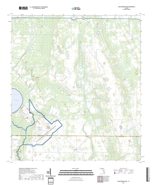
2024 Map of Lake Arbuckle NE
USGS Topo · Published 2024About this map
Avon Park AF Range dominates this Central Florida landscape, where military aviation infrastructure meets the native hydrology of the Kissimmee River basin. The survey clearly delineates the MacDill Air Force Base Auxiliary Field and the adjacent Arbuckle Airfield, highlighting the region's continued importance for defense training and aerospace operations. This intersection of military utility and natural wetlands is a defining characteristic of the area south of the Polk and Highlands County line.
Find a feature on this map
20 named features on this map. Tap any name to fly to it.
Don’t see what you’re looking for? This feature index may not catch every label — zoom into the map to look around manually.
Map Details
Editions of this 2024 Lake Arbuckle NE Map
This is the sole edition of this map. No revisions or reprints were ever made.
Other maps of this area

1952 · Fort Kissimmee
USGS Topo · 1:24,000

1952 · Lake Weohyakapka SE
USGS Topo · 1:24,000

1952 · Lake Arbuckle SW
USGS Topo · 1:24,000

1952 · Fort Kissimmee NW
USGS Topo · 1:24,000

1952 · Lake Arbuckle NE
USGS Topo · 1:24,000

1952 · Lake Arbuckle SE
USGS Topo · 1:24,000

1952 · Lake Arbuckle
USGS Topo · 1:24,000

1952 · Lake Weohyakapka
USGS Topo · 1:24,000

1953 · Lake Marian SW
USGS Topo · 1:24,000

1956 · Fort Pierce
USGS Topo · 1:250,000