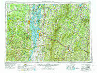
1962 Map of Lake Champlain
USGS Topo · Published 1975About this map
Lake Champlain serves as the central anchor for this expansive regional view, flanked by the Adirondack Mountains to the west and the Green Mountains to the east. The map captures the area during a period of established military and educational growth, featuring major installations like Plattsburgh Air Force Base and Ethan Allen Air Force Base alongside institutions such as the University of Vermont and Middlebury College. This edition reflects a landscape where heavy industry and natural conservation coexist; the legacy of extraction is evident at the Lyon Mountain Iron Mine and Witherbee-Sherman Iron Mine, while the vast Adirondack Park and Green Mountain National Forest protect the high peaks of Mt Marcy and Mt Mansfield. The transportation network is well-defined by the Delaware & Hudson RR and the burgeoning interstate system, including Interstate 87 and Interstate 89, illustrating the connectivity between New York, Vermont, and the Canadian border.
Find a feature on this map
294 named features on this map. Tap any name to fly to it.
Don’t see what you’re looking for? This feature index may not catch every label — zoom into the map to look around manually.
Map Details
Editions of this 1962 Lake Champlain Map
3 editions found

Other maps of this area

1894 · Elizabethtown
USGS Topo · 1:62,500

1894 · Port Henry
USGS Topo · 1:62,500

1894 · Plattsburg
USGS Topo · 1:62,500

1894 · Ticonderoga
USGS Topo · 1:62,500

1895 · Mooers
USGS Topo · 1:62,500

1895 · Rouse Point
USGS Topo · 1:62,500

1895 · Willsboro
USGS Topo · 1:62,500

1895 · Elizabethtown
USGS Topo · 1:62,500

1895 · Mt. Marcy
USGS Topo · 1:62,500

1895 · Ausable
USGS Topo · 1:62,500