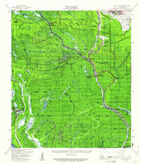
1959 Map of Lake Chicot
USGS Topo · Published 1961About this map
Grand River and the Lower Grand River dominate this Louisiana landscape, weaving through the wetlands of Iberville Parish and St Martin Parish. By the late 1950s, the region’s economy was defined by a shift from traditional river life to industrial extraction, evidenced by the proliferation of sites like the Bayou Sorrel Oil Field, Sullivans Lake Gas Field, and East Bayou Pigeon Gas Field. This transition is set against a backdrop of established community anchors such as the Grand River Sch and the Jack Miller Store.
Find a feature on this map
57 named features on this map. Tap any name to fly to it.
Don’t see what you’re looking for? This feature index may not catch every label — zoom into the map to look around manually.
Map Details
Editions of this 1959 Lake Chicot Map
4 editions found
Other maps of this area

1908 · Baton Rouge
USGS Topo · 1:62,500

1935 · Osca Bayou
USGS Topo · 1:62,500

1935 · Chicot Lake
USGS Topo · 1:62,500

1936 · White Castle
USGS Topo · 1:62,500

1937 · Jeanerette
USGS Topo · 1:62,500

1939 · Baton Rouge
USGS Topo · 1:62,500

1940 · Grosse Tete
USGS Topo · 1:62,500

1941 · Loreauville
USGS Topo · 1:62,500

1945 · New Orleans
USGS Topo · 1:250,000

1948 · Foster
USGS Topo · 1:62,500