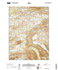
2019 Map of Lake Clark A-7 NW
USGS Topo · Published 2019About this map
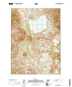
The Lake and Peninsula Borough landscape in this 2019 survey is defined by an intricate network of wetlands, ponds, and small lakes characteristic of the Alaskan wilderness. The map focuses on a series of township and range divisions, including T2n R36w, T1n R36w, and T2n R37w, which provide the primary spatial framework for this unpopulated terrain. The absence of named settlements or roads underscores the region's preservation as a primitive natural environment, where the topography is shaped by water and glacial legacy rather than human development. For the researcher or land manager, the sheet provides the precise boundaries for T1n R37w and the northern edge of T1s R36w, offering a detailed view of the hydrology and elevation contours that dictate the area's drainage patterns and habitat structure.
Find a feature on this map
5 named features on this map. Tap any name to fly to it.
Don’t see what you’re looking for? This feature index may not catch every label — zoom into the map to look around manually.
Map Details
Editions of this 2019 Lake Clark A-7 NW Map
This is the sole edition of this map. No revisions or reprints were ever made.
Other maps of this area

1946 · Lake Clark
USGS Topo · 1:250,000

1951 · Lake Clark
USGS Topo · 1:250,000

1954 · Lake Clark A-7
USGS Topo · 1:63,360

1954 · Lake Clark A-8
USGS Topo · 1:63,360
1954 · Lake Clark B-8
USGS Topo · 1:63,360
1954 · Lake Clark B-7
USGS Topo · 1:63,360

1958 · Lake Clark
USGS Topo · 1:250,000
2019 · Lake Clark B-8 SE
USGS Topo · 1:25,000
2019 · Lake Clark B-7 SE
USGS Topo · 1:25,000
2019 · Lake Clark A-8 NE
USGS Topo · 1:25,000