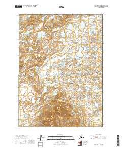
2019 Map of Lake Clark A-8 SW
USGS Topo · Published 2019About this map
The Chulitna River and Swan River define this wilderness corridor within the Lake and Peninsula Borough as it appeared in the late 2010s. This survey records a landscape characterized by an intricate network of unnamed lakes and wetlands that occupy the low-lying basins between localized topographic rises. The drainage patterns of the Swan River in the southwest and the Chulitna River in the east are the primary geographic markers in a region otherwise devoid of named settlements or infrastructure. The map illustrates the transition from saturated river valley floors to more defined upland terrain, providing a look at the hydrography of this remote Alaskan interior before any significant modern development or road construction was introduced to the area.
Find a feature on this map
7 named features on this map. Tap any name to fly to it.
Don’t see what you’re looking for? This feature index may not catch every label — zoom into the map to look around manually.
Map Details
Editions of this 2019 Lake Clark A-8 SW Map
This is the sole edition of this map. No revisions or reprints were ever made.
Other maps of this area

1946 · Lake Clark
USGS Topo · 1:250,000

1950 · Taylor Mountains
USGS Topo · 1:250,000

1951 · Lake Clark
USGS Topo · 1:250,000

1951 · Taylor Mountains
USGS Topo · 1:250,000

1951 · Dillingham
USGS Topo · 1:250,000

1952 · Iliamna
USGS Topo · 1:250,000

1954 · Lake Clark A-8
USGS Topo · 1:63,360

1954 · Iliamna D-8
USGS Topo · 1:63,360

1954 · Taylor Mountains
USGS Topo · 1:250,000

1954 · Dillingham
USGS Topo · 1:250,000