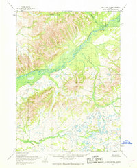
1954 Map of Lake Clark B-8
USGS Topo · Published 1968About this map
The Mulchatna River serves as the central artery of this interior landscape, meandering through a series of broad valleys and wetland flats. Photogrammetric methods from 1950s aerial photography reveal a region defined by its hydrography, where the Chilchitna River joins the main flow amidst a complex network of unnamed lakes and drainage basins. Evidence of human presence is sparse but specific, noted by a cluster of Cabins situated along a river bend, likely serving as seasonal shelters or base camps for travelers navigating the waterways. The surrounding terrain is documented with 50-foot contours, rising toward an Overlook and the northern reaches of Springway Creek. This 1954 field-annotated study captures the undisturbed character of the Alaska bush before extensive modern development, preserving the exact locations of early wilderness structures and natural landmarks.
Find a feature on this map
5 named features on this map. Tap any name to fly to it.
Don’t see what you’re looking for? This feature index may not catch every label — zoom into the map to look around manually.
Map Details
Editions of this 1954 Lake Clark B-8 Map
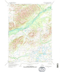
2 editions found
Other maps of this area

1946 · Lake Clark
USGS Topo · 1:250,000

1950 · Taylor Mountains
USGS Topo · 1:250,000

1951 · Lake Clark
USGS Topo · 1:250,000

1951 · Taylor Mountains
USGS Topo · 1:250,000

1954 · Lake Clark C-7
USGS Topo · 1:63,360

1954 · Lake Clark A-7
USGS Topo · 1:63,360

1954 · Lake Clark A-8
USGS Topo · 1:63,360

1954 · Lake Clark C-8
USGS Topo · 1:63,360

1954 · Taylor Mountains
USGS Topo · 1:250,000

1954 · Taylor Mountains C-1
USGS Topo · 1:63,360