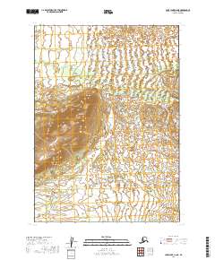
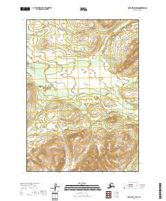
2019 Map of Lake Clark C-6 NE
USGS Topo · Published 2019About this map
Marys Mtn dominates the central landscape of this wilderness area within the Lake and Peninsula Borough. The terrain is defined by a complex network of hydrological features, notably the drainage systems of Bonanza Creek and Big Bonanza Creek. This 2019 survey, produced by the U.S. Geological Survey, meticulously documents the township and range boundaries across several sections including t7n r33w, t7n r32w, and t8n r33w. The map illustrates a landscape of elevation and water, where the intricate contours reveal the relationship between the peak of Marys Mtn and the surrounding creek basins.
Find a feature on this map
9 named features on this map. Tap any name to fly to it.
Don’t see what you’re looking for? This feature index may not catch every label — zoom into the map to look around manually.
Map Details
Editions of this 2019 Lake Clark C-6 NE Map
This is the sole edition of this map. No revisions or reprints were ever made.
Other maps of this area

1946 · Lake Clark
USGS Topo · 1:250,000

1951 · Lake Clark
USGS Topo · 1:250,000

1954 · Lake Clark C-6
USGS Topo · 1:63,360

1954 · Lake Clark D-5
USGS Topo · 1:63,360

1954 · Lake Clark C-5
USGS Topo · 1:63,360
1954 · Lake Clark D-6
USGS Topo · 1:63,360

1958 · Lake Clark
USGS Topo · 1:250,000
2018 · Lake Clark C-5 NW
USGS Topo · 1:25,000
2018 · Lake Clark D-5 SW
USGS Topo · 1:25,000
2018 · Lake Clark C-5 SW
USGS Topo · 1:25,000