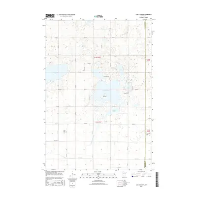
2016 Map of Lake Elizabeth
USGS Topo · Published 2016About this map
Lake Elizabeth dominates the center of this rural landscape, featuring the prominent Big Island and a connection to Carrie Lake via Lake Elizabeth Pass. Located along the border where Kandiyohi and Meeker counties meet, the area is defined by its extensive lacustrine systems and agricultural drainage, most notably the channel of State Ditch Number One. Local history is anchored by several burial sites that serve as landmarks for the surrounding farming community, including Lake Elizabeth Cem to the west and Oak Grove Cem situated near the eastern shore. Smaller water bodies like Mennetaga Lake and Summit Lake dot the northern sections, while Rosendale Cem sits in the southeast, providing valuable points of reference for genealogists tracing family roots in this lake-rich portion of Minnesota.
Find a feature on this map
40 named features on this map. Tap any name to fly to it.
Don’t see what you’re looking for? This feature index may not catch every label — zoom into the map to look around manually.
Map Details
Editions of this 2016 Lake Elizabeth Map
This is the sole edition of this map. No revisions or reprints were ever made.
Other maps of this area

1953 · New Ulm
USGS Topo · 1:250,000

1953 · Saint Cloud
USGS Topo · 1:250,000

1956 · Atwater
USGS Topo · 1:62,500

1957 · Saint Cloud
USGS Topo · 1:250,000

1957 · New Ulm
USGS Topo · 1:250,000

1957 · Olivia
USGS Topo · 1:62,500

1958 · New Ulm
USGS Topo · 1:250,000

1958 · Saint Cloud
USGS Topo · 1:250,000

1967 · New Ulm
USGS Topo · 1:250,000

1967 · Grove City
USGS Topo · 1:24,000