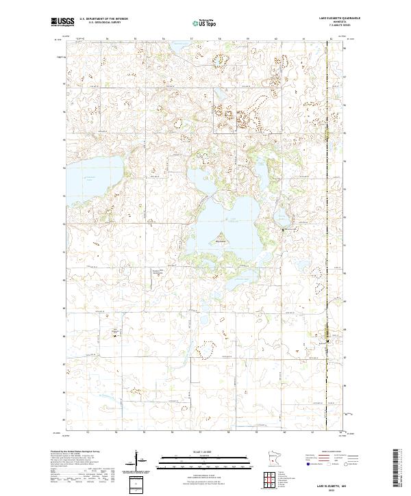
2022 Map of Lake Elizabeth
USGS Topo · Published 2022About this map
The glacial waters of Lake Elizabeth and Mennetaga Lake dominate this portion of the Kandiyohi and Meeker county line, reflecting a landscape defined by its wetlands and prairie depressions. This 2022 survey documents a rural environment where land management is visible through features like State Ditch Number One and Br Number Two, which drain the low-lying areas between lakes. The human history of the region is anchored by local burial grounds, including the Lake Elizabeth Cem, Oak Grove Cem, and Rosendale Cem, each serving as a landmark for the surrounding farming community. A notable modern addition to the landscape is the Stanton Hill Aerodrome, situated just south of the main lake body. The map illustrates the grid-based road system typical of the Midwest, with routes like Co Rd 86 and 105th Ave SE connecting isolated farmsteads and the various lakefronts.
Find a feature on this map
38 named features on this map. Tap any name to fly to it.
Don’t see what you’re looking for? This feature index may not catch every label — zoom into the map to look around manually.
Map Details
Editions of this 2022 Lake Elizabeth Map
This is the sole edition of this map. No revisions or reprints were ever made.
Other maps of this area

1953 · New Ulm
USGS Topo · 1:250,000

1953 · Saint Cloud
USGS Topo · 1:250,000

1956 · Atwater
USGS Topo · 1:62,500

1957 · Saint Cloud
USGS Topo · 1:250,000

1957 · New Ulm
USGS Topo · 1:250,000

1957 · Olivia
USGS Topo · 1:62,500

1958 · New Ulm
USGS Topo · 1:250,000

1958 · Saint Cloud
USGS Topo · 1:250,000

1967 · New Ulm
USGS Topo · 1:250,000

1967 · Grove City
USGS Topo · 1:24,000