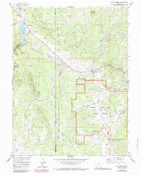
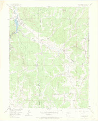
1956 Map of Lake George
USGS Topo · Published 1985About this map
Florissant Fossil Beds National Monument anchors the southern portion of this landscape, preserving a remarkable geologic record alongside the established mountain settlements. The community of Florissant sits at the intersection of local routes, while to the northwest, Lake George serves as a hub for both water management and recreation near the South Platte River. The map reveals the infrastructure of the mid-20th century, including an extensive Aqueduct system and a Pumping Sta that support the region's water needs. Evidence of earlier transportation networks is preserved in the Old Railroad Grade and Railroad Grade cutting across the terrain toward Twin Creek. Within the Pike National Forest, specialized sites like Camp Alexander and the Riverside Campground indicate the long-standing role of this area for youth and public recreation. High points like Crystal Peak and Blue Mountain define the horizon, overlooking a complex system of gulches and creeks that feed the South Platte.
Find a feature on this map
27 named features on this map. Tap any name to fly to it.
Don’t see what you’re looking for? This feature index may not catch every label — zoom into the map to look around manually.
Map Details
Editions of this 1956 Lake George Map
7 editions found

Other maps of this area

1893 · Platte Canyon
USGS Topo · 1:125,000

1894 · Pikes Peak
USGS Topo · 1:125,000

1901 · Pikes Peak
USGS Topo · 1:125,000

1901 · Pikes Peak
USGS Topo · 1:62,500

1951 · Cripple Creek North
USGS Topo · 1:24,000

1953 · Denver
USGS Topo · 1:250,000

1954 · Signal Butte
USGS Topo · 1:24,000

1954 · Divide
USGS Topo · 1:24,000

1954 · Pueblo
USGS Topo · 1:250,000

1956 · Tarryall
USGS Topo · 1:24,000