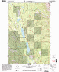
1999 Map of Lake Inez
USGS Topo · Published 2003About this map
Lolo National Forest encompasses the high country of Missoula County in this late 20th-century survey, centered on the glacial chain of the Clearwater River. The map documents the vital water system connecting Lake Alva and Lake Inez, where the river serves as a corridor for both natural drainage and recreational activity. High in the northeast corner, the boundary of the Bob Marshall Wilderness and the Flathead Nat For suggests the preservation of primitive backcountry adjacent to managed forest lands.
Find a feature on this map
22 named features on this map. Tap any name to fly to it.
Don’t see what you’re looking for? This feature index may not catch every label — zoom into the map to look around manually.
Map Details
Editions of this 1999 Lake Inez Map
This is the sole edition of this map. No revisions or reprints were ever made.
Other maps of this area

1902 · Ovando
USGS Topo · 1:125,000

1905 · Ovando
USGS Topo · 1:125,000

1921 · Elbow Lake
USGS Topo · 1:125,000

1955 · Choteau
USGS Topo · 1:250,000

1957 · Choteau
USGS Topo · 1:250,000

1958 · Choteau
USGS Topo · 1:250,000

1962 · Choteau
USGS Topo · 1:250,000

1965 · Upper Jocko Lake
USGS Topo · 1:24,000

1965 · Holland Lake
USGS Topo · 1:24,000

1965 · Seeley Lake West
USGS Topo · 1:24,000