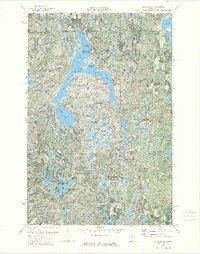
1972 Map of Lake Itasca
USGS Topo · Published 1974About this map
Lake Itasca serves as the focal point of this 1972 survey, highlighting the renowned headwaters of the Mississippi River. This orthophotomap, which combines photographic imagery with topographic data, reveals the intricate shoreline of the lake's North Arm, West Arm, and East Arm. Historically significant sites for researchers include the Pioneer Cem and the Univ of Minn Forestry Sch, both situated near the northern park boundaries. The map provides a detailed view of Itasca State Park before late-20th-century developments, showing established campgrounds like Pine Ridge Campground and Bear Paw Campground. To the south, the landscape transitions into a dense network of smaller glacial lakes, including Elk Lake and Hernando DeSoto Lake, where fire surveillance is marked by the Alton Heights Lookout Tower.
Find a feature on this map
93 named features on this map. Tap any name to fly to it.
Don’t see what you’re looking for? This feature index may not catch every label — zoom into the map to look around manually.
Map Details
Editions of this 1972 Lake Itasca Map
2 editions found
Other maps of this area

1954 · Bemidji
USGS Topo · 1:250,000

1957 · Bemidji
USGS Topo · 1:250,000

1958 · Bemidji
USGS Topo · 1:250,000

1969 · Anchor Hill
USGS Topo · 1:24,000

1969 · Big Basswood Lake
USGS Topo · 1:24,000

1969 · Heart Lake
USGS Topo · 1:24,000

1972 · La Salle Lake
USGS Topo · 1:24,000
1972 · Two Inlets
USGS Topo · 1:24,000
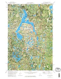
1972 · Lake Itasca
USGS Topo · 1:24,000
1972 · Lake Hattie
USGS Topo · 1:24,000