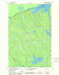
1963 Map of Lake Jeanette
USGS Topo · Published 1987About this map
Loon Lake and the international boundary between Ontario and Minnesota define the northern edge of this wilderness landscape, where the Rainy River District of Canada meets the northern reaches of the United States. This remote section of the Superior National Forest is characterized by a complex network of waterways, including the Little Indian Sioux River and the Hunting Shack River, which flow through the protected Boundary Waters Canoe Area Wilderness.
Find a feature on this map
31 named features on this map. Tap any name to fly to it.
Don’t see what you’re looking for? This feature index may not catch every label — zoom into the map to look around manually.
Map Details
Editions of this 1963 Lake Jeanette Map
3 editions found
Other maps of this area

1954 · International Falls
USGS Topo · 1:250,000

1957 · International Falls
USGS Topo · 1:250,000

1958 · International Falls
USGS Topo · 1:250,000

1963 · Echo Lake
USGS Topo · 1:24,000

1963 · Takucmich Lake
USGS Topo · 1:24,000

1963 · Snow Bay
USGS Topo · 1:24,000

1963 · Astrid Lake
USGS Topo · 1:24,000

1963 · Picket Lake
USGS Topo · 1:24,000

1963 · Lake Jeanette
USGS Topo · 1:24,000

1963 · Crane Lake
USGS Topo · 1:24,000