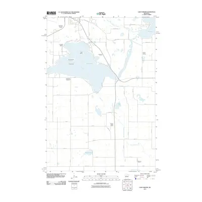
2010 Map of Lake Koronis
USGS Topo · Published 2010About this map
Lake Koronis and its distinct chain of islands—First Island, Second Island, and Third Island—anchor this Stearns County landscape. The map reveals a transition between aquatic recreation and the agricultural patterns of central Minnesota, with significant landmarks such as the Lake Koronis Assembly Ground and the Lake Koronis Regional Park Campground lining the shores. The North Fork Crow River snakes southward from Rice Lake, eventually meeting the Middle Fork Crow River at the bottom of the quadrangle. Local aviation is well-represented by the Paynesville Municipal Airport in the northwest and the smaller Empire Valley Airport to the south. For those researching family history, the map precisely locates the Ebenezer Church Cemetery and Manannah Cemetery, which remain as long-standing fixtures within the rural grid of county highways and township roads.
Find a feature on this map
52 named features on this map. Tap any name to fly to it.
Don’t see what you’re looking for? This feature index may not catch every label — zoom into the map to look around manually.
Map Details
Editions of this 2010 Lake Koronis Map
This is the sole edition of this map. No revisions or reprints were ever made.
Other maps of this area

1953 · Saint Cloud
USGS Topo · 1:250,000

1956 · Atwater
USGS Topo · 1:62,500

1957 · Saint Cloud
USGS Topo · 1:250,000

1958 · Saint Cloud
USGS Topo · 1:250,000

1967 · Grove City
USGS Topo · 1:24,000

1967 · Paynesville
USGS Topo · 1:24,000

1967 · Litchfield North
USGS Topo · 1:24,000

1967 · Lake Koronis
USGS Topo · 1:24,000

1967 · Richmond
USGS Topo · 1:24,000

1967 · Hawick
USGS Topo · 1:24,000