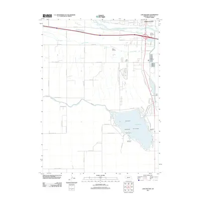
2011 Map of Lake Maloney
USGS Topo · Published 2011About this map
Lake Maloney dominates the southern landscape of this Lincoln County survey, providing a central hub for recreation and water management south of North Platte. The reservoir is characterized by several named landforms including Scout Island, Goose Island, and Two Tree Island, while its shores are home to the Lake Maloney Golf Course and the Frontier Resort and RV Park. This 2011 documentation captures a region defined by its hydrology, where the South Platte River and its accompanying sloughs—Beer Slough and Fremont Slough—parallel the major transportation corridors. Significant infrastructure like the North Platte Fish Hatchery and the Outlet Canal system illustrate the managed nature of these Plains waterways. Closer to the city, local heritage is marked at Saint Patrick Cemetery and Floral Lawns Memorial Gardens, while the transition from urban streets to rural routes like S Wagon Trail Rd and W State Farm Rd reflects the area's agricultural backbone.
Find a feature on this map
36 named features on this map. Tap any name to fly to it.
Don’t see what you’re looking for? This feature index may not catch every label — zoom into the map to look around manually.
Map Details
Editions of this 2011 Lake Maloney Map
This is the sole edition of this map. No revisions or reprints were ever made.
Other maps of this area

1899 · North Platte
USGS Topo · 1:125,000

1902 · North Platte
USGS Topo · 1:125,000

1954 · McCook
USGS Topo · 1:250,000

1954 · North Platte
USGS Topo · 1:250,000

1956 · North Platte
USGS Topo · 1:250,000

1956 · Wellfleet NW
USGS Topo · 1:24,000

1957 · North Platte
USGS Topo · 1:250,000

1957 · McCook
USGS Topo · 1:250,000

1958 · McCook
USGS Topo · 1:250,000

1967 · North Platte
USGS Topo · 1:250,000