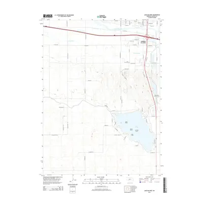
2014 Map of Lake Maloney
USGS Topo · Published 2014About this map
Lake Maloney and its surrounding hydrology dominate this Nebraska landscape just south of North Platte. The intricate network of waterways includes the South Platte River, Beer Slough, and Fremont Slough, alongside the engineered Outlet Canal. The lake itself is detailed with several named landforms, including Scout Island, Goose Island, Two Tree Island, and Duck Island, which illustrate the local topography and recreational geography of the area.
Find a feature on this map
36 named features on this map. Tap any name to fly to it.
Don’t see what you’re looking for? This feature index may not catch every label — zoom into the map to look around manually.
Map Details
Editions of this 2014 Lake Maloney Map
This is the sole edition of this map. No revisions or reprints were ever made.
Other maps of this area

1899 · North Platte
USGS Topo · 1:125,000

1902 · North Platte
USGS Topo · 1:125,000

1954 · McCook
USGS Topo · 1:250,000

1954 · North Platte
USGS Topo · 1:250,000

1956 · North Platte
USGS Topo · 1:250,000

1956 · Wellfleet NW
USGS Topo · 1:24,000

1957 · North Platte
USGS Topo · 1:250,000

1957 · McCook
USGS Topo · 1:250,000

1958 · McCook
USGS Topo · 1:250,000

1967 · North Platte
USGS Topo · 1:250,000