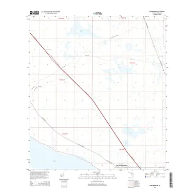
2015 Map of Lake Marian NE
USGS Topo · Published 2015About this map
Lake Marian Highlands sits at the southern edge of this Central Florida landscape, where the residential footprint meets the sprawling wetlands of the Kissimmee River basin. The terrain is defined by its water systems, including Lake Marian and a series of smaller bodies such as Island Pond and Arnold Pond. These natural features are bisected by the heavy infrastructure of the Florida's Tpke, which cuts a diagonal path through the township sections.
Find a feature on this map
24 named features on this map. Tap any name to fly to it.
Don’t see what you’re looking for? This feature index may not catch every label — zoom into the map to look around manually.
Map Details
Editions of this 2015 Lake Marian NE Map
This is the sole edition of this map. No revisions or reprints were ever made.
Other maps of this area

1953 · Lake Marian NW
USGS Topo · 1:24,000

1953 · Lake Marian SE
USGS Topo · 1:24,000

1953 · Holopaw SE
USGS Topo · 1:24,000

1953 · Kenansville SW
USGS Topo · 1:24,000

1953 · Lake Marian SW
USGS Topo · 1:24,000

1953 · Kenansville
USGS Topo · 1:24,000

1953 · Holopaw SW
USGS Topo · 1:24,000

1953 · Deer Park
USGS Topo · 1:24,000

1953 · Lake Marian NE
USGS Topo · 1:24,000

1955 · Orlando
USGS Topo · 1:250,000