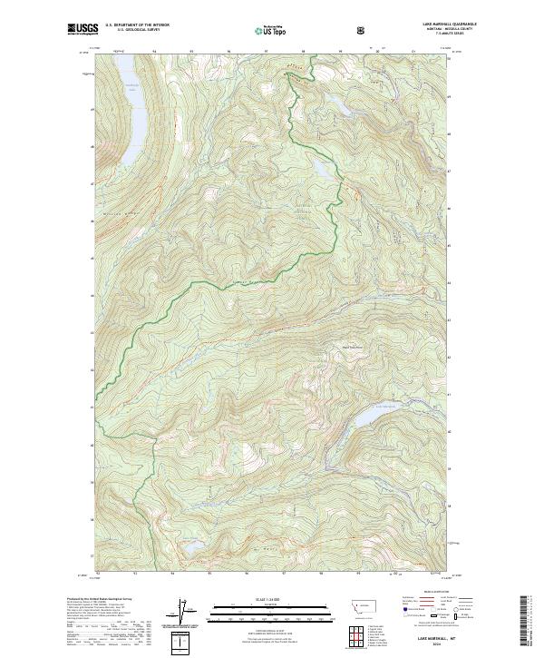
2024 Map of Lake Marshall
USGS Topo · Published 2024About this map
Mission Mountains Wilderness and the surrounding national forests define this high-altitude landscape in Missoula County. The terrain is characterized by a dense network of glacial lakes and river headwaters, including Lindbergh Lake in the northwest and Lake Marshall in the east. This 2024 edition documents the modern boundary between the Flathead National Forest and Lolo National Forest, with significant topographical features like Sunset Peak and Mt Henry serving as natural landmarks. A complex system of forest roads and trails, such as the W Fork Clearwater Rd and the Lake Marshall Loop Trl, provides access to the West Fork Clearwater River and smaller alpine water bodies like Colt Lake and Lake Dinah. The map illustrates how primitive access routes like the Jocko Trl continue to weave through these protected lands.
Find a feature on this map
37 named features on this map. Tap any name to fly to it.
Don’t see what you’re looking for? This feature index may not catch every label — zoom into the map to look around manually.
Map Details
Editions of this 2024 Lake Marshall Map
This is the sole edition of this map. No revisions or reprints were ever made.
Other maps of this area

1921 · Elbow Lake
USGS Topo · 1:125,000

1955 · Choteau
USGS Topo · 1:250,000

1957 · Choteau
USGS Topo · 1:250,000

1958 · Choteau
USGS Topo · 1:250,000

1962 · Choteau
USGS Topo · 1:250,000

1965 · Upper Jocko Lake
USGS Topo · 1:24,000
1965 · Belmore Sloughs
USGS Topo · 1:24,000

1965 · Holland Lake
USGS Topo · 1:24,000

1965 · Seeley Lake West
USGS Topo · 1:24,000

1965 · Gray Wolf Lake
USGS Topo · 1:24,000