
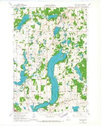
1966 Map of Lake Osakis East
USGS Topo · Published 1967About this map
Lake Osakis dominates this mid-1960s survey of Todd County, revealing a landscape defined by its glacial waters and agricultural boundaries. The eastern shoreline is marked by prominent landforms such as Battle Point, Crow Point, and Miller Point, while the northern reaches show the winding path of the Prairie River as it feeds into Long Lake. This period captures the rural infrastructure of central Minnesota before significant modern consolidation, preserving the locations of local landmarks like Townhall and several country churches including Leslie Ch and Gordon Ch.
Find a feature on this map
38 named features on this map. Tap any name to fly to it.
Don’t see what you’re looking for? This feature index may not catch every label — zoom into the map to look around manually.
Map Details
Editions of this 1966 Lake Osakis East Map
This is the sole edition of this map. No revisions or reprints were ever made.
Other maps of this area

1953 · Brainerd
USGS Topo · 1:250,000

1953 · Saint Cloud
USGS Topo · 1:250,000

1957 · Brainerd
USGS Topo · 1:250,000

1957 · Saint Cloud
USGS Topo · 1:250,000

1958 · Saint Cloud
USGS Topo · 1:250,000

1958 · Brainerd
USGS Topo · 1:250,000

1965 · Brainerd
USGS Topo · 1:250,000

1966 · West Union
USGS Topo · 1:24,000

1966 · Osakis
USGS Topo · 1:24,000
1966 · Sauk Lake
USGS Topo · 1:24,000