
1953 Map of Lake Poinsett
USGS Topo · Published 1953About this map
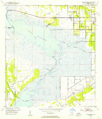
Lake Poinsett and the serpentine St Johns River anchor this mid-century Florida landscape, revealing a period when the riverine environment began to intersect with modern infrastructure. The map documents an intricate network of water management, visible through the extensive Levee systems and numerous Spoil Banks that line the river's path toward Lake Winder. Settlement patterns are concentrated in the northeast corner around Cocoa and Rockledge, while the wetlands to the west remain largely dominated by fishing and hunting outposts like Lone Cabbage Camp and Poinsett Lodge. A curious local detail is the Trailer Park Cem near the newly established highways, while Mulberry Mound suggests much older layers of human presence on the river's edge. The inclusion of Lake Florence and Barnett Lake highlights the basin's complex drainage before later 20th-century developments.
Find a feature on this map
25 named features on this map. Tap any name to fly to it.
Don’t see what you’re looking for? This feature index may not catch every label — zoom into the map to look around manually.
Map Details
Editions of this 1953 Lake Poinsett Map
4 editions found
Other maps of this area

1949 · Courtenay
USGS Topo · 1:24,000

1949 · Eau Gallie
USGS Topo · 1:24,000

1949 · Sharpes
USGS Topo · 1:24,000

1949 · Cocoa
USGS Topo · 1:24,000

1951 · Eau Gallie
USGS Topo · 1:24,000

1951 · Cocoa
USGS Topo · 1:24,000

1951 · Courtenay
USGS Topo · 1:24,000

1951 · Sharpes
USGS Topo · 1:24,000

1953 · Deer Park NE
USGS Topo · 1:24,000

1953 · Deer Park NW
USGS Topo · 1:24,000