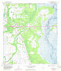
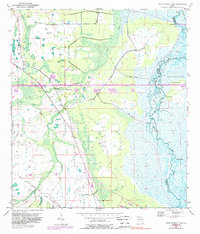
1953 Map of Lake Poinsett NW
USGS Topo · Published 1981About this map
The St Johns River meanders along the boundary of the Delespine Grant, defining a landscape of wetlands and riverine bluffs. This 1953 survey, updated with late-1970s photogrammetry, captures the transition of the Florida interior as modern infrastructure began to cross its traditional drainage systems. The Bee Line Expressway (Toll Road) bisects the terrain, providing a stark contrast to older transit markers like the Old Railroad Grade found further south.
Find a feature on this map
12 named features on this map. Tap any name to fly to it.
Don’t see what you’re looking for? This feature index may not catch every label — zoom into the map to look around manually.
Map Details
Editions of this 1953 Lake Poinsett NW Map
6 editions found
Other maps of this area

1949 · Titusville
USGS Topo · 1:24,000

1949 · Sharpes
USGS Topo · 1:24,000

1951 · Sharpes
USGS Topo · 1:24,000

1952 · Titusville
USGS Topo · 1:24,000

1953 · Lake Poinsett
USGS Topo · 1:24,000

1953 · Narcoossee NE
USGS Topo · 1:24,000

1953 · Narcoossee SE
USGS Topo · 1:24,000

1953 · Lake Poinsett SW
USGS Topo · 1:24,000

1953 · Titusville SW
USGS Topo · 1:24,000

1953 · Lake Poinsett NW
USGS Topo · 1:24,000