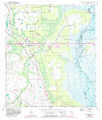
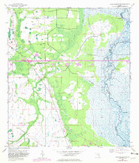
1953 Map of Lake Poinsett NW
USGS Topo · Published 1989About this map
The St Johns River defines the eastern wetlands of this landscape, winding through a complex system of marshes and channels within the historic Delespine Grant. Surveyed in the early 1950s with subsequent revisions, the map illustrates a rural Florida interior undergoing modernization. The straight path of the Bee Line Expressway (Toll Road) cuts across the center, contrasting with the sinuous natural drainage of Second Creek and Sweetwater Branch. Remnants of earlier transit are visible in the southwest, where an Old Railroad Grade traverses the terrain. Topographical landmarks such as Possum Bluff and Long Bluff rise above the low-lying basins near Halfway Lake, while localized features like the Flowing Well and various Spoil Banks indicate human efforts to manage and reside in this swampy frontier.
Find a feature on this map
12 named features on this map. Tap any name to fly to it.
Don’t see what you’re looking for? This feature index may not catch every label — zoom into the map to look around manually.
Map Details
Editions of this 1953 Lake Poinsett NW Map
6 editions found
Other maps of this area

1949 · Titusville
USGS Topo · 1:24,000

1949 · Sharpes
USGS Topo · 1:24,000

1951 · Sharpes
USGS Topo · 1:24,000

1952 · Titusville
USGS Topo · 1:24,000

1953 · Lake Poinsett
USGS Topo · 1:24,000

1953 · Narcoossee NE
USGS Topo · 1:24,000

1953 · Narcoossee SE
USGS Topo · 1:24,000

1953 · Lake Poinsett SW
USGS Topo · 1:24,000

1953 · Titusville SW
USGS Topo · 1:24,000

1953 · Lake Poinsett NW
USGS Topo · 1:24,000