
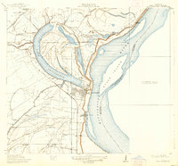
1911 Map of Lake Providence
USGS Topo · Published 1911About this map
The oxbow of Lake Providence dominates the landscape of East Carroll Parish, where the curved waters separate the main settlement from the sprawling Tyrone Plantation and Indian Mounds to the north. Surveyed in cooperation with the Fifth Louisiana Levee District, this map reveals a complex agrarian and river economy at the start of the 1910s. The powerful Mississippi River defines the eastern boundary, shifting past Stack Island and leaving behind secondary channels like The Chute and Round Lake.
Find a feature on this map
40 named features on this map. Tap any name to fly to it.
Don’t see what you’re looking for? This feature index may not catch every label — zoom into the map to look around manually.
Map Details
Editions of this 1911 Lake Providence Map
2 editions found
Other maps of this area

1909 · Baxter Bayou
USGS Topo · 1:24,000

1909 · Lake Providence
USGS Topo · 1:24,000

1909 · Wilsons Point
USGS Topo · 1:24,000

1909 · Millikin
USGS Topo · 1:24,000

1909 · Ashton Bridge
USGS Topo · 1:24,000

1911 · Baxter Bayou
USGS Topo · 1:24,000

1912 · Ashton Bridge
USGS Topo · 1:31,680

1913 · Wilson Point
USGS Topo · 1:31,680

1914 · Baxter Bayou
USGS Topo · 1:31,680

1935 · Oak Grove
USGS Topo · 1:62,500