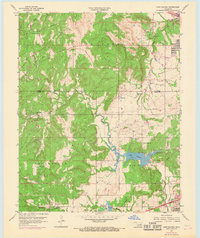
1959 Map of Lake Sahoma
USGS Topo · Published 1968About this map
Lake Sahoma and the surrounding Oil Field districts of Creek County define this mid-century landscape on the outskirts of the Tulsa metropolitan area. The topography is deeply carved by watercourses like Rock Creek and Fisher Creek, which weave through the Red Fork and Kellyville regions. This 1950s survey, updated in the late 1960s, documents the rural infrastructure supporting these communities, from the St L - S F RR tracks to the local landmarks like Pretty Water School and Limestone Church.
Find a feature on this map
26 named features on this map. Tap any name to fly to it.
Don’t see what you’re looking for? This feature index may not catch every label — zoom into the map to look around manually.
Map Details
Editions of this 1959 Lake Sahoma Map
4 editions found
Other maps of this area

1901 · Nuyaka
USGS Topo · 1:125,000

1912 · Hominy
USGS Topo · 1:125,000

1914 · Kiefer
USGS Topo · 1:62,500

1915 · Hominy
USGS Topo · 1:125,000

1916 · Kiefer
USGS Topo · 1:62,500

1916 · Bristow
USGS Topo · 1:62,500

1954 · Oklahoma City
USGS Topo · 1:250,000

1955 · Enid
USGS Topo · 1:250,000

1956 · Sand Springs
USGS Topo · 1:24,000

1956 · Sapulpa North
USGS Topo · 1:24,000