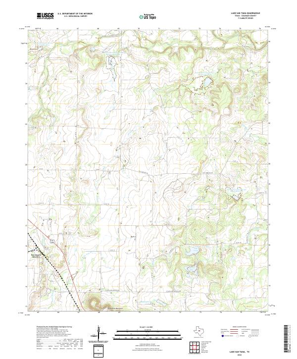
2022 Map of Lake San Tana
USGS Topo · Published 2022About this map
San Angelo Junction sits at the western edge of this central Texas landscape, where rail infrastructure and rural roads converge in Coleman County. The terrain is defined by the northern reaches of the Santa Anna Mountains, which rise above a network of seasonal drainages including Mukewater Cr and Santa Anna Br. This 2022 survey illustrates the modern hydrological management of the region, featuring numerous engineered basins such as the Soil Conservation Service Site 32 Reservoir and Soil Conservation Service Site 26a Reservoir. The presence of Lake San Tana and Lake Sealy in the southeast quadrant suggests a landscape heavily adapted for water retention and local recreation. Historical transportation patterns remain visible through the alignment of Old Comanche Rd, which cuts across the central plains, intersecting contemporary routes like FM 1176.
Find a feature on this map
42 named features on this map. Tap any name to fly to it.
Don’t see what you’re looking for? This feature index may not catch every label — zoom into the map to look around manually.
Map Details
Editions of this 2022 Lake San Tana Map
This is the sole edition of this map. No revisions or reprints were ever made.
Other maps of this area

1887 · Coleman
USGS Topo · 1:125,000

1889 · Coleman
USGS Topo · 1:125,000

1924 · Brownwood Reservoir Site
USGS Topo · 1:48,000

1927 · Grosvenor
USGS Topo · 1:62,500

1954 · Brownwood
USGS Topo · 1:250,000

1960 · Lake Scarborough
USGS Topo · 1:24,000
1960 · Coleman NE
USGS Topo · 1:24,000
1960 · Burkett
USGS Topo · 1:24,000

1962 · Santa Anna
USGS Topo · 1:24,000
1962 · Bangs West
USGS Topo · 1:24,000