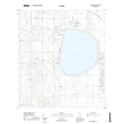
2018 Map of Lake Weohyakapka
USGS Topo · Published 2018About this map
Lake Weohyakapka dominates this landscape, its wide waters framed by a complex network of wetlands and upland ridges. To the north, the retirement communities of Nalcrest and Fedhaven are laid out with distinct circular street patterns and residential drives like Mark Twain Dr and Emerson Dr. The geography is defined by the Lake Wales Ridge, a prominent geological feature that provides higher ground amidst the surrounding lowlands.
Find a feature on this map
100 named features on this map. Tap any name to fly to it.
Don’t see what you’re looking for? This feature index may not catch every label — zoom into the map to look around manually.
Map Details
Editions of this 2018 Lake Weohyakapka Map
This is the sole edition of this map. No revisions or reprints were ever made.
Other maps of this area

1952 · Lake Wales
USGS Topo · 1:24,000

1952 · Lake Weohyakapka SE
USGS Topo · 1:24,000

1952 · Lake Weohyakapka NE
USGS Topo · 1:24,000

1952 · Lake Arbuckle NE
USGS Topo · 1:24,000

1952 · Babson Park
USGS Topo · 1:24,000

1952 · Hesperides
USGS Topo · 1:24,000

1952 · Lake Arbuckle
USGS Topo · 1:24,000

1952 · Lake Weohyakapka
USGS Topo · 1:24,000

1953 · Frostproof
USGS Topo · 1:24,000

1956 · Fort Pierce
USGS Topo · 1:250,000