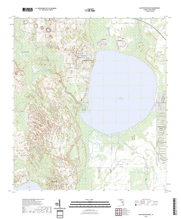
2024 Map of Lake Weohyakapka
USGS Topo · Published 2024About this map
Lake Weohyakapka dominates the central landscape of this Polk County region, serving as the focal point for surrounding residential developments and conservation efforts. To the north, the retirement communities of Nalcrest and Fedhaven sit near the shoreline, while the extensive grid of Indian Lake Estates occupies the eastern territory. The map illustrates a contemporary balance between human settlement and environmental preservation, with significant portions of the land designated as the Everglades Headwaters National Wildlife Refuge and Conservation Area and the Lake Wales Ridge State Forest. In the southwest corner, the northern edge of Frostproof appears near Reedy Lake. The terrain is defined by the Lake-Wales Ridge, characterized by a network of sandy trails like Tiger Creek Trl and Walk In Water Rd that navigate through the Blue Jordan Swamp and Tiger Creek Hammock.
Find a feature on this map
103 named features on this map. Tap any name to fly to it.
Don’t see what you’re looking for? This feature index may not catch every label — zoom into the map to look around manually.
Map Details
Editions of this 2024 Lake Weohyakapka Map
This is the sole edition of this map. No revisions or reprints were ever made.
Other maps of this area

1952 · Lake Wales
USGS Topo · 1:24,000

1952 · Lake Weohyakapka SE
USGS Topo · 1:24,000

1952 · Lake Weohyakapka NE
USGS Topo · 1:24,000

1952 · Lake Arbuckle NE
USGS Topo · 1:24,000

1952 · Babson Park
USGS Topo · 1:24,000

1952 · Hesperides
USGS Topo · 1:24,000

1952 · Lake Arbuckle
USGS Topo · 1:24,000

1952 · Lake Weohyakapka
USGS Topo · 1:24,000

1953 · Frostproof
USGS Topo · 1:24,000

1956 · Fort Pierce
USGS Topo · 1:250,000