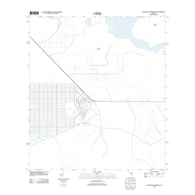
2012 Map of Lake Weohyakapka SE
USGS Topo · Published 2012About this map
Lake Kissimmee and Tiger Lake dominate the northern portion of this Polk County landscape, separated by the low-lying Thomas Shoal. The 2012 survey illustrates a distinctive transitional area between the expansive wetlands of the Kissimmee River basin and the structured residential developments emerging in the southern interior. A dense grid of streets, named for major Florida cities like Miami Dr, Palm Beach Dr, and St Petersburg Dr, is clearly visible near the Indian Lake Fire Tower, reflecting a planned community layout that contrasts sharply with the nearby wild waters and the isolated Brahma Island. Access to this remote region is facilitated by routes like Co Hwy-630 and Sam Keen Rd, which trace the edge of the wetlands and the developing rural residential blocks.
Find a feature on this map
21 named features on this map. Tap any name to fly to it.
Don’t see what you’re looking for? This feature index may not catch every label — zoom into the map to look around manually.
Map Details
Editions of this 2012 Lake Weohyakapka SE Map
This is the sole edition of this map. No revisions or reprints were ever made.
Other maps of this area

1952 · Lake Weohyakapka SE
USGS Topo · 1:24,000

1952 · Lake Weohyakapka NE
USGS Topo · 1:24,000

1952 · Fort Kissimmee NW
USGS Topo · 1:24,000

1952 · Lake Arbuckle NE
USGS Topo · 1:24,000

1952 · Hesperides
USGS Topo · 1:24,000

1952 · Lake Arbuckle
USGS Topo · 1:24,000

1952 · Lake Weohyakapka
USGS Topo · 1:24,000

1953 · Lake Marian NW
USGS Topo · 1:24,000

1953 · Lake Marian SW
USGS Topo · 1:24,000

1956 · Fort Pierce
USGS Topo · 1:250,000