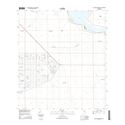
2015 Map of Lake Weohyakapka SE
USGS Topo · Published 2015About this map
Lake Kissimmee and its surrounding wetlands define this landscape along the Osceola and Polk County line. The northern reaches of the quadrangle feature the vast waters of the lake, including the shoals of Thomas Shoal and the landmass of Brahma Island. A dense network of residential streets, many named for tropical flora like Allamanda Drive and Oleander Drive, indicates a significant mid-to-late 20th-century development pattern concentrated west of the lake's edge.
Find a feature on this map
63 named features on this map. Tap any name to fly to it.
Don’t see what you’re looking for? This feature index may not catch every label — zoom into the map to look around manually.
Map Details
Editions of this 2015 Lake Weohyakapka SE Map
This is the sole edition of this map. No revisions or reprints were ever made.
Other maps of this area

1952 · Lake Weohyakapka SE
USGS Topo · 1:24,000

1952 · Lake Weohyakapka NE
USGS Topo · 1:24,000

1952 · Fort Kissimmee NW
USGS Topo · 1:24,000

1952 · Lake Arbuckle NE
USGS Topo · 1:24,000

1952 · Hesperides
USGS Topo · 1:24,000

1952 · Lake Arbuckle
USGS Topo · 1:24,000

1952 · Lake Weohyakapka
USGS Topo · 1:24,000

1953 · Lake Marian NW
USGS Topo · 1:24,000

1953 · Lake Marian SW
USGS Topo · 1:24,000

1956 · Fort Pierce
USGS Topo · 1:250,000