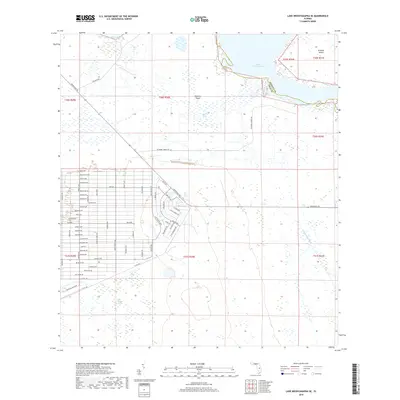
2018 Map of Lake Weohyakapka SE
USGS Topo · Published 2018About this map
Lake Kissimmee dominates the northeastern landscape of this region, where the boundary between Osceola and Polk Counties follows the water's edge. The terrain is a complex network of wetlands and seasonal watercourses, featuring Otter Slough and Buttermilk Slough, which drain into the larger lake system. A prominent landform, Brahma Island, sits within the lake, while Thomas Shoal marks a distinct navigational or geological point in the water body. To the west, Tiger Lake and the dense vegetation of Blue Jordan Swamp illustrate the subtropical hydrology of the area.
Find a feature on this map
56 named features on this map. Tap any name to fly to it.
Don’t see what you’re looking for? This feature index may not catch every label — zoom into the map to look around manually.
Map Details
Editions of this 2018 Lake Weohyakapka SE Map
This is the sole edition of this map. No revisions or reprints were ever made.
Other maps of this area

1952 · Lake Weohyakapka SE
USGS Topo · 1:24,000

1952 · Lake Weohyakapka NE
USGS Topo · 1:24,000

1952 · Fort Kissimmee NW
USGS Topo · 1:24,000

1952 · Lake Arbuckle NE
USGS Topo · 1:24,000

1952 · Hesperides
USGS Topo · 1:24,000

1952 · Lake Arbuckle
USGS Topo · 1:24,000

1952 · Lake Weohyakapka
USGS Topo · 1:24,000

1953 · Lake Marian NW
USGS Topo · 1:24,000

1953 · Lake Marian SW
USGS Topo · 1:24,000

1956 · Fort Pierce
USGS Topo · 1:250,000