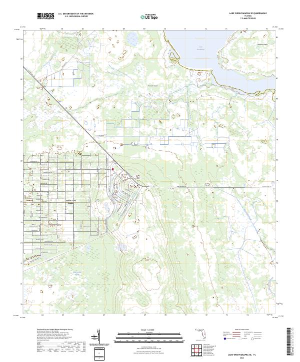
2024 Map of Lake Weohyakapka SE
USGS Topo · Published 2024About this map
Indian Lake Estates occupies the southwestern portion of this map, characterized by its grid of residential streets with tropical botanical names such as Tropicana Dr and Hibiscus Dr. This development is framed by a landscape defined by water and wetlands, stretching toward the massive Lake Kissimmee in the northeast. The terrain between the settlement and the lake is a complex network of drainage and lowlands, including the wide Otter Slough and Thomas Shoal. To the east, the map captures the western edge of Brahma Island, while the southern reaches are dominated by the extensive Blue Jordan Swamp and smaller waterways like Buttermilk Slough and Packingham Slough. The region's transit is linked by Hesperides Rd and Kissimmee Shores Rd, illustrating the intersection of planned Florida retirement communities and the enduring, wild wetlands of the Kissimmee River basin.
Find a feature on this map
70 named features on this map. Tap any name to fly to it.
Don’t see what you’re looking for? This feature index may not catch every label — zoom into the map to look around manually.
Map Details
Editions of this 2024 Lake Weohyakapka SE Map
This is the sole edition of this map. No revisions or reprints were ever made.
Other maps of this area

1952 · Lake Weohyakapka SE
USGS Topo · 1:24,000

1952 · Lake Weohyakapka NE
USGS Topo · 1:24,000

1952 · Fort Kissimmee NW
USGS Topo · 1:24,000

1952 · Lake Arbuckle NE
USGS Topo · 1:24,000

1952 · Hesperides
USGS Topo · 1:24,000

1952 · Lake Arbuckle
USGS Topo · 1:24,000

1952 · Lake Weohyakapka
USGS Topo · 1:24,000

1953 · Lake Marian NW
USGS Topo · 1:24,000

1953 · Lake Marian SW
USGS Topo · 1:24,000

1956 · Fort Pierce
USGS Topo · 1:250,000