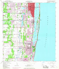
1945 Map of Lake Worth
USGS Topo · Published 1968About this map
Lake Worth and its neighboring coastal communities are captured here during a period of significant post-war expansion along the Florida coast. The map illustrates a landscape defined by the parallel corridors of the Florida East Coast and Seaboard Coast Line railroads, which facilitated the growth of inland settlements like Greenacres City and seaside hubs like Boynton Beach. The central coastal lagoon is bisected by Hypoluxo Island, while the South Lake Worth Inlet Haulover provides critical access between the inland waters and the Atlantic Ocean.
Find a feature on this map
20 named features on this map. Tap any name to fly to it.
Don’t see what you’re looking for? This feature index may not catch every label — zoom into the map to look around manually.
Map Details
Editions of this 1945 Lake Worth Map
4 editions found
Other maps of this area

1945 · Greenacres City
USGS Topo · 1:24,000

1945 · Lake Worth
USGS Topo · 1:24,000

1946 · Palm Beach Farms
USGS Topo · 1:24,000

1946 · Palm Beach
USGS Topo · 1:24,000

1947 · Delmar Farms
USGS Topo · 1:24,000

1949 · Lake Worth
USGS Topo · 1:24,000

1949 · Palm Beach Farms
USGS Topo · 1:24,000

1949 · Delmar Farms
USGS Topo · 1:24,000

1950 · Delray Beach
USGS Topo · 1:24,000

1950 · Greenacres City
USGS Topo · 1:24,000