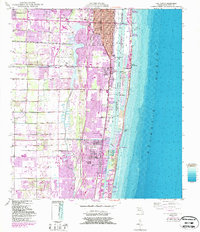
1945 Map of Lake Worth
USGS Topo · Published 1987About this map
Lake Osborne and the winding Intracoastal Waterway define the coastal geography of this mid-century Florida survey. The map details the rapid postwar expansion of the Gold Coast, showing a dense network of suburban developments such as Palm Springs, Atlantis, and Greenacres City moving inland from the established shore. This era captures the transition of the region from a citrus and railroad corridor to a vacation and residential hub, with transportation infrastructure provided by the Seaboard Coast Line and Florida East Coast railroads.
Find a feature on this map
30 named features on this map. Tap any name to fly to it.
Don’t see what you’re looking for? This feature index may not catch every label — zoom into the map to look around manually.
Map Details
Editions of this 1945 Lake Worth Map
4 editions found
Other maps of this area

1945 · Greenacres City
USGS Topo · 1:24,000

1945 · Lake Worth
USGS Topo · 1:24,000

1946 · Palm Beach Farms
USGS Topo · 1:24,000

1946 · Palm Beach
USGS Topo · 1:24,000

1947 · Delmar Farms
USGS Topo · 1:24,000

1949 · Lake Worth
USGS Topo · 1:24,000

1949 · Palm Beach Farms
USGS Topo · 1:24,000

1949 · Delmar Farms
USGS Topo · 1:24,000

1950 · Delray Beach
USGS Topo · 1:24,000

1950 · Greenacres City
USGS Topo · 1:24,000