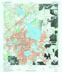
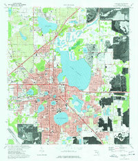
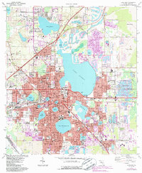
1975 Map of Lakeland
USGS Topo · Published 1983About this map
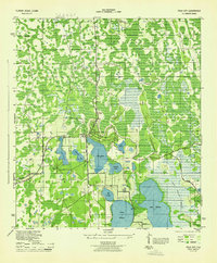
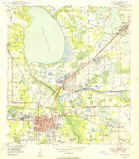
The city of Lakeland is defined by its remarkable lake network, with major water bodies like Lake Parker, Lake Hollingsworth, and Lake Morton shaping the urban layout. This mid-1970s survey illustrates a period of significant municipal development, showcasing the Florida Southern College campus and public venues such as Joker Marchant Stadium and Bryant Stadium. Beyond the city core, the landscape transitions into industrial use, specifically noted by the strip mines encroaching from the northeast and southwest, which highlight the regional phosphate mining economy. The Seaboard Coast Line provides a heavy rail backbone for both the city and the surrounding industries. Smaller outlying settlements like Griffin, Gibsonia, and Eaton Park are visible, each maintaining distinct identities with their own local landmarks such as Griffin Cem and Eaton Park school facilities. Numerous religious and educational institutions, including the South-Eastern Bible College, appear throughout the residential grids.
Find a feature on this map
112 named features on this map. Tap any name to fly to it.
Don’t see what you’re looking for? This feature index may not catch every label — zoom into the map to look around manually.
Map Details
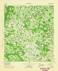
Editions of this 1975 Lakeland Map
3 editions found
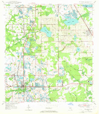
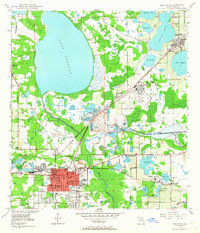
Other maps of this area

1944 · Plant City
USGS Topo · 1:31,680
1944 · Providence
USGS Topo · 1:31,680
1944 · Polk City
USGS Topo · 1:31,680

1944 · Lakeland
USGS Topo · 1:31,680

1944 · Auburndale
USGS Topo · 1:31,680
1944 · Socrum
USGS Topo · 1:31,680
1949 · Mulberry
USGS Topo · 1:24,000
1949 · Bartow
USGS Topo · 1:24,000
1950 · Mulberry
USGS Topo · 1:24,000
1950 · Bartow
USGS Topo · 1:24,000