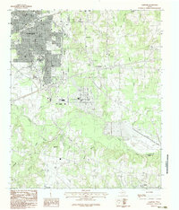
1983 Map of Lakeport
USGS Topo · Published 1983About this map
Longview expands across the northwestern portion of this East Texas survey, marked by the campus of Le Tourneau College and the industrial infrastructure typical of the region's energy-rich economy. The landscape is defined by the winding course of the Sabine River, which serves as a natural boundary between Gregg and Harrison Counties. This area shows a transition from the urban density of the city to the rural communities of Lakeport, Gum Springs, and Estes.
Find a feature on this map
24 named features on this map. Tap any name to fly to it.
Don’t see what you’re looking for? This feature index may not catch every label — zoom into the map to look around manually.
Map Details
Editions of this 1983 Lakeport Map
2 editions found
Other maps of this area

1936 · Kilgore
USGS Topo · 1:48,000

1940 · Kilgore
USGS Topo · 1:62,500

1956 · Tyler
USGS Topo · 1:250,000

1958 · Tatum
USGS Topo · 1:62,500

1960 · White Oak
USGS Topo · 1:24,000

1961 · Hallsville
USGS Topo · 1:24,000

1962 · Longview Heights
USGS Topo · 1:24,000

1971 · Kilgore NE
USGS Topo · 1:24,000
1971 · Kilgore SE
USGS Topo · 1:24,000

1983 · Tatum
USGS Topo · 1:24,000