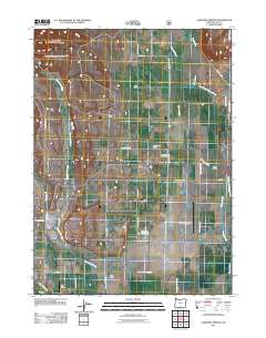
2011 Map of Lakeview Airport
USGS Topo · Published 2011About this map
Thomas Creek and Cottonwood Creek dominate this high-desert basin in Lake County, where irrigation infrastructure and aviation have long shaped the rural landscape. The map highlights a network of water management features including the Number Six Canal, Baldwin Ditch, and Farleighs Reservoir, which support the scattered ranching operations that define the area. Local history is grounded in family-named properties like Leehmann Ranch and Reed Ranch, along with small hubs such as Five Corners and New Idaho. Transportation and leisure are central to the district, anchored by the Lake County-Lakeview Airport and Mark Clark Golf Course. Further west, the smaller Farr Airport and Roberts Ranch sit near the base of the rising terrain, illustrating the sparse but organized settlement pattern of the Oregon interior in the early 21st century.
Find a feature on this map
34 named features on this map. Tap any name to fly to it.
Don’t see what you’re looking for? This feature index may not catch every label — zoom into the map to look around manually.
Map Details
Editions of this 2011 Lakeview Airport Map
This is the sole edition of this map. No revisions or reprints were ever made.
Other maps of this area

1955 · Klamath Falls
USGS Topo · 1:250,000

1958 · Klamath Falls
USGS Topo · 1:250,000

1964 · Lakeview NE
USGS Topo · 1:24,000

1964 · Crooked Creek Valley
USGS Topo · 1:24,000

1964 · Lakeview SW
USGS Topo · 1:24,000

1964 · Cox Flat
USGS Topo · 1:24,000

1964 · Lakeview NW
USGS Topo · 1:24,000
1964 · Fitzwater Point
USGS Topo · 1:24,000

1964 · Drews Gap
USGS Topo · 1:24,000
1964 · Crane Creek
USGS Topo · 1:24,000