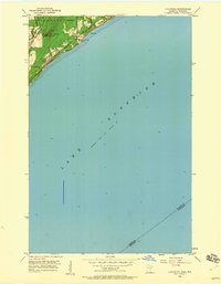
1953 Map of Lakewood
USGS Topo · Published 1960About this map
Lake Superior dominates this mid-century coastal survey, where the rugged shoreline of Duluth meets the deep waters of the Great Lakes. The map illustrates a critical transportation corridor along the northern coast, defined by the parallel tracks of the Duluth Missabe and Iron Range Road and the established routes of North Shore Drive and Old North Shore Road. These arteries connect the residential community at Lakewood with the larger city to the southwest, passing through a landscape where steep terrain like Moose Mountain overlooks the mouth of the Lester River.
Find a feature on this map
14 named features on this map. Tap any name to fly to it.
Don’t see what you’re looking for? This feature index may not catch every label — zoom into the map to look around manually.
Map Details
Editions of this 1953 Lakewood Map
4 editions found
Other maps of this area

1895 · Duluth
USGS Topo · 1:62,500

1915 · Superior
USGS Topo · 1:48,000

1917 · Superior
USGS Topo · 1:62,500

1949 · Poplar
USGS Topo · 1:48,000

1953 · Lakewood
USGS Topo · 1:24,000

1953 · French River
USGS Topo · 1:24,000

1953 · Arnold
USGS Topo · 1:24,000

1953 · Duluth
USGS Topo · 1:24,000

1953 · Knife River
USGS Topo · 1:24,000

1953 · Duluth
USGS Topo · 1:62,500