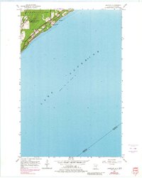
1953 Map of Lakewood
USGS Topo · Published 1980About this map
Lake Superior dominates this mid-century survey, its expansive waters meeting the shoreline along the eastern edge of Duluth. The settlement of Lakewood serves as a focal point where the Duluth Missabe and Iron Range railroad tracks parallel the coast, tracing a corridor of early industrial and transit development. The mapping shows a landscape transitioning from the urban boundary into the wooded slopes of Moose Mountain, with several scenic thoroughfares including the Kitchi Gammi Parkway and Old North Shore Road following the natural contours of the lake. Local infrastructure and community life are marked by the Pumping Station and the North Shore Chapel, while the Lester River cuts through the terrain toward the lake. The inclusion of the Minnesota Wisconsin state line across the water and the St Louis Co Douglas Co boundary highlights the map's role in defining regional borders.
Find a feature on this map
17 named features on this map. Tap any name to fly to it.
Don’t see what you’re looking for? This feature index may not catch every label — zoom into the map to look around manually.
Map Details
Editions of this 1953 Lakewood Map
4 editions found
Other maps of this area

1895 · Duluth
USGS Topo · 1:62,500

1915 · Superior
USGS Topo · 1:48,000

1917 · Superior
USGS Topo · 1:62,500

1949 · Poplar
USGS Topo · 1:48,000

1953 · Lakewood
USGS Topo · 1:24,000

1953 · French River
USGS Topo · 1:24,000

1953 · Arnold
USGS Topo · 1:24,000

1953 · Duluth
USGS Topo · 1:24,000

1953 · Knife River
USGS Topo · 1:24,000

1953 · Duluth
USGS Topo · 1:62,500