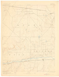
1892 Map of Lamar
USGS Topo · Published 1902About this map
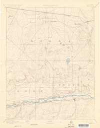
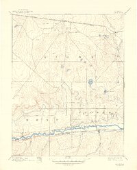
The Arkansas River corridor in southeastern Colorado dominates this 1890s landscape, serving as the primary anchor for settlement and transportation. Along its southern bank, the Atchison Topeka and Santa Fe Railroad facilitates the growth of Lamar, while a complex network of irrigation infrastructure including the Arkansas Valley Canal and the Colorado and Kansas Canal begins to transform the high plains. Further north, the Missouri Pacific Railroad carves a straight path through Kiowa County, connecting small whistle-stops like Eads, Diston, and Chivington. This era highlights a shift from natural water dependence to engineered water management, evidenced by King Reservoir and Prince Reservoir. Notable local landmarks like Kiowa Springs and the somberly named Graveyard Creek provide essential reference points for genealogists tracing early land claims in Bent and Prowers counties.
Find a feature on this map
25 named features on this map. Tap any name to fly to it.
Don’t see what you’re looking for? This feature index may not catch every label — zoom into the map to look around manually.
Map Details
Editions of this 1892 Lamar Map
7 editions found
Other maps of this area

1890 · Granada
USGS Topo · 1:125,000

1891 · Arroyo
USGS Topo · 1:125,000

1891 · Albany
USGS Topo · 1:125,000

1891 · Kit Carson
USGS Topo · 1:125,000

1891 · Higbee
USGS Topo · 1:125,000

1891 · Las Animas
USGS Topo · 1:125,000

1892 · Lamar
USGS Topo · 1:125,000

1892 · Cheyenne Wells
USGS Topo · 1:125,000

1892 · Granada
USGS Topo · 1:125,000

1892 · Two Butte
USGS Topo · 1:125,000