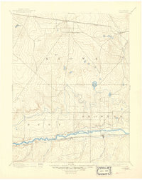
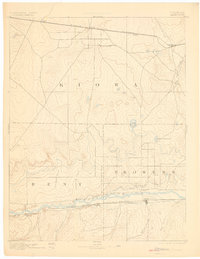
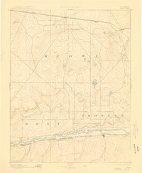
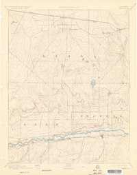
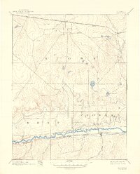
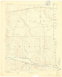
1892 Map of Lamar
USGS Topo · Published 1906About this map
The Arkansas River serves as the central artery for this high-plains landscape, where late 19th-century irrigation and rail infrastructure began to transform eastern Colorado. Along the southern corridor, the Atchison Topeka and Santa Fe Railroad parallels the river, connecting the growing settlement of Lamar with outposts like Caddo. The development of the Arkansas Valley Canal signifies early efforts to manage water in the arid Arkansas Valley, a necessity for the homesteaders arriving in Prowers and Bent counties.
Find a feature on this map
26 named features on this map. Tap any name to fly to it.
Don’t see what you’re looking for? This feature index may not catch every label — zoom into the map to look around manually.
Map Details
Editions of this 1892 Lamar Map
7 editions found

Other maps of this area

1890 · Granada
USGS Topo · 1:125,000

1891 · Arroyo
USGS Topo · 1:125,000

1891 · Albany
USGS Topo · 1:125,000

1891 · Kit Carson
USGS Topo · 1:125,000

1891 · Higbee
USGS Topo · 1:125,000

1891 · Las Animas
USGS Topo · 1:125,000

1892 · Lamar
USGS Topo · 1:125,000

1892 · Cheyenne Wells
USGS Topo · 1:125,000
1892 · Granada
USGS Topo · 1:125,000

1892 · Two Butte
USGS Topo · 1:125,000