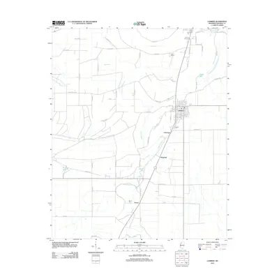
2012 Map of Lambert
USGS Topo · Published 2012About this map
The settlement of Lambert anchors this Mississippi Delta landscape, where a dense grid of streets including Scott Ave and Darby Ave meets the surrounding agricultural expanse. The area's drainage and hydrology are defined by the meandering courses of Buzzard Bayou and Buck Bayou, along with named water bodies like Buckskin Lake and Buford Lake. To the south and east, smaller named locales such as Yarbrough, Oliverfried, and Denton reflect the rural development patterns of Quitman County. Local landmarks like Selfs Airport and the Lambert Cem provide specific points of interest for those tracing the community's infrastructure and family heritage. The network of rural roads, including Killebrew Rd and Dorsey Lake Rd, connects these disparate settlements and family-named landmarks across the flat terrain.
Find a feature on this map
75 named features on this map. Tap any name to fly to it.
Don’t see what you’re looking for? This feature index may not catch every label — zoom into the map to look around manually.
Map Details
Editions of this 2012 Lambert Map
This is the sole edition of this map. No revisions or reprints were ever made.
Other maps of this area

1908 · Jonestown
USGS Topo · 1:24,000

1910 · Jonestown
USGS Topo · 1:31,680

1932 · Sledge
USGS Topo · 1:48,000

1932 · Tutwiler
USGS Topo · 1:48,000

1932 · Marks
USGS Topo · 1:48,000

1935 · Crowder
USGS Topo · 1:62,500

1935 · Marks
USGS Topo · 1:62,500

1935 · Tutwiler
USGS Topo · 1:62,500

1935 · Sledge
USGS Topo · 1:62,500

1939 · Sledge
USGS Topo · 1:62,500