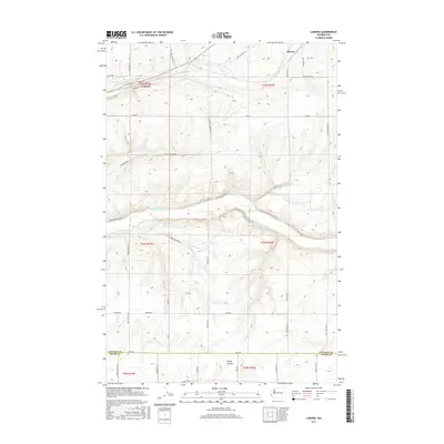
2017 Map of Lamona
USGS Topo · Published 2017About this map
Lamona and Downs anchor the northern landscape of this Lincoln County survey, situated within a high-plateau environment defined by deep-set watercourses and a rigid grid of agricultural roads. The drainage of Crab Creek and its tributary Coal Cr cut through the terrain, creating distinct elevation changes that contrast with the flat agricultural sections. South of the main creek bed, Rocky Coulee carves through the southern sections near the border of Adams County, illustrating the transition between the channeled scabland features and the surrounding upland. The map documents an extensive network of named rural routes, such as Carlson Rd N and Iverson Corner Rd N, which delineate family landholdings and connect these small shipping points. This 2017 edition provides a clear record of modern land divisions and preserved drainage patterns in a region historically shaped by the influence of the railroad and the vast wheat-growing economy of eastern Washington.
Find a feature on this map
44 named features on this map. Tap any name to fly to it.
Don’t see what you’re looking for? This feature index may not catch every label — zoom into the map to look around manually.
Map Details
Editions of this 2017 Lamona Map
This is the sole edition of this map. No revisions or reprints were ever made.
Other maps of this area

1953 · Ritzville
USGS Topo · 1:250,000

1959 · Ritzville
USGS Topo · 1:250,000

1965 · Ritzville
USGS Topo · 1:250,000

1967 · Schoonover
USGS Topo · 1:24,000

1967 · Ritzville NE
USGS Topo · 1:24,000

1967 · Ritzville NW
USGS Topo · 1:24,000

1968 · Sylvan Lake
USGS Topo · 1:24,000

1968 · Coffeepot Lake
USGS Topo · 1:24,000

1969 · Harrington
USGS Topo · 1:24,000

1969 · Cormana Lake
USGS Topo · 1:24,000