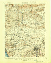
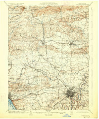
1904 Map of Lancaster
USGS Topo · Published 1946About this map
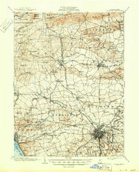
Furnace Ridge and South Mountain define the northern highlands of this landscape, where the Elizabeth Furnace Gap and Governor Dick Hill overlook a complex network of early Pennsylvania industry and transport. The interior is a dense grid of nineteenth-century turnpikes, including the Manheim and Lancaster Turnpike and the Lancaster and Ephrata Turnpike, which connected agricultural hubs like Lititz and Manheim to the regional center of Lancaster.
Find a feature on this map
119 named features on this map. Tap any name to fly to it.
Don’t see what you’re looking for? This feature index may not catch every label — zoom into the map to look around manually.
Map Details
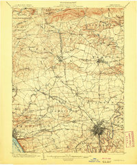
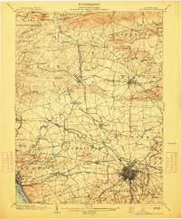
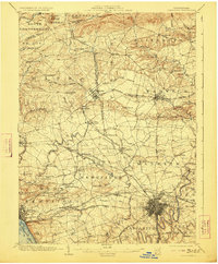
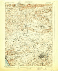
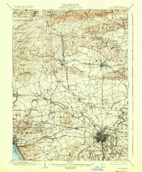
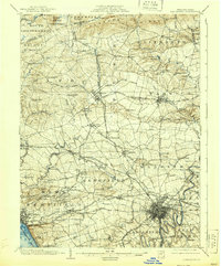
Editions of this 1904 Lancaster Map
10 editions found
Other maps of this area

1891 · Lebanon
USGS Topo · 1:62,500

1892 · Hummelstown
USGS Topo · 1:62,500

1893 · Lebanon
USGS Topo · 1:62,500

1899 · Lebanon
USGS Topo · 1:62,500

1902 · Wernersville
USGS Topo · 1:62,500

1902 · Lancaster
USGS Topo · 1:62,500

1904 · Lancaster
USGS Topo · 1:62,500

1906 · New Holland
USGS Topo · 1:62,500

1908 · Middletown
USGS Topo · 1:62,500

1908 · New Holland
USGS Topo · 1:62,500
Featured Places
- Lancaster, PA
- West Lampeter Township, PA
- Lititz, PA
- Willow Street, West Lampeter Township
- Millersville, PA