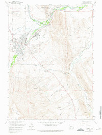
1960 Map of Lander
USGS Topo · Published 1975About this map
Lander stands at the confluence of the Middle Popo Agie River and North Fork Popo Agie River, serving as a central hub in Fremont County during the mid-20th century. The settlement pattern is defined by the Chicago and Northwestern Railway terminus and a sophisticated network of irrigation canals, including the Chicago Ditch and Dutch Flat Ditch, which supported agriculture in the valley. Just outside the main town, the Wind River Indian Reservation Boundary marks the northern landscape near the Lander Oil Field.
Find a feature on this map
61 named features on this map. Tap any name to fly to it.
Don’t see what you’re looking for? This feature index may not catch every label — zoom into the map to look around manually.
Map Details
Editions of this 1960 Lander Map
3 editions found
Other maps of this area

1952 · Hudson
USGS Topo · 1:24,000

1952 · Ray Lake
USGS Topo · 1:24,000

1952 · Lander SE
USGS Topo · 1:24,000

1952 · Lander
USGS Topo · 1:24,000

1952 · Lander NW
USGS Topo · 1:24,000

1953 · Fossil Hill
USGS Topo · 1:24,000

1953 · Weiser Pass
USGS Topo · 1:24,000

1953 · Mount Arter SE
USGS Topo · 1:24,000

1954 · Wolf Point
USGS Topo · 1:24,000

1955 · Lander
USGS Topo · 1:250,000