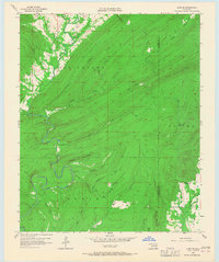
1957 Map of Lane NE
USGS Topo · Published 1967About this map
Kosoma Valley and the surrounding timbered ridges of the Ouachita Mountains define this landscape during the mid-1950s. The terrain is deeply incised by a dense network of drainages, most notably McGee Creek and its many tributaries like Wildcat Canyon and Bugaboo Canyon. While much of the area remains undeveloped, evidence of local industry and infrastructure appears in the form of a Cable Car and Gaging Station along the creek, as well as Oil Tanks located near Ray Creek in the northwest.
Find a feature on this map
32 named features on this map. Tap any name to fly to it.
Don’t see what you’re looking for? This feature index may not catch every label — zoom into the map to look around manually.
Map Details
Editions of this 1957 Lane NE Map
3 editions found

Other maps of this area

1898 · McAlester
USGS Topo · 1:125,000

1901 · Antlers
USGS Topo · 1:125,000

1909 · Mc Alester
USGS Topo · 1:125,000

1912 · Antlers
USGS Topo · 1:125,000

1925 · Antlers
USGS Topo · 1:125,000

1950 · Mcalester
USGS Topo · 1:250,000

1957 · Lane NW
USGS Topo · 1:24,000

1957 · Farris
USGS Topo · 1:24,000

1957 · Moyers
USGS Topo · 1:24,000

1957 · Jumbo
USGS Topo · 1:24,000